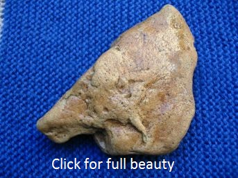
Der Europakompass von Wegberg stellt eine in Stein skizzierte Karte des eiszeitlichen Europas dar, welche bei Tag an der Sonne und bei Nacht am Polarstern in der geographisch richtigen Lage orientiert werden kann.
The Europe compass of Wegberg is a map of the glacial Europe sketched in stone, which can be oriented by the sun during the day and at night by the polar star into the geographically correct Position.
Beschreibung des Europakompasses In Englisch und Deutsch Wissenschaftliche Analyse durch das Labor für Kartografie der Uni Duisburg-Essen Genauigkeitsuntersuchung des Europa-Kompasses von Hans Grams in Englisch und Deutsch Genauigkeitsuntersuchung des Europa-Kompasses von Hans Grams in Französisch
|
Ruf aus der Altsteinzeit - Stiftung (Call from the Paleolithic - Foundation, built in 2008)
This website exists since 2005
Ecce, non legas haec paginas, nisi legis illas sine ira et studio!
Fund der Woche Neandertaler aus der Dordogne
eingestellt am 20.07.2024
Finding of the weekNeanderthals from the Dordogne posted at 07.20.2024
| © 2013. Ruf aus der Altsteinzeit - Stiftung. All rights reserved. |

